Should I Purchase Mine Subsidence Insurance?
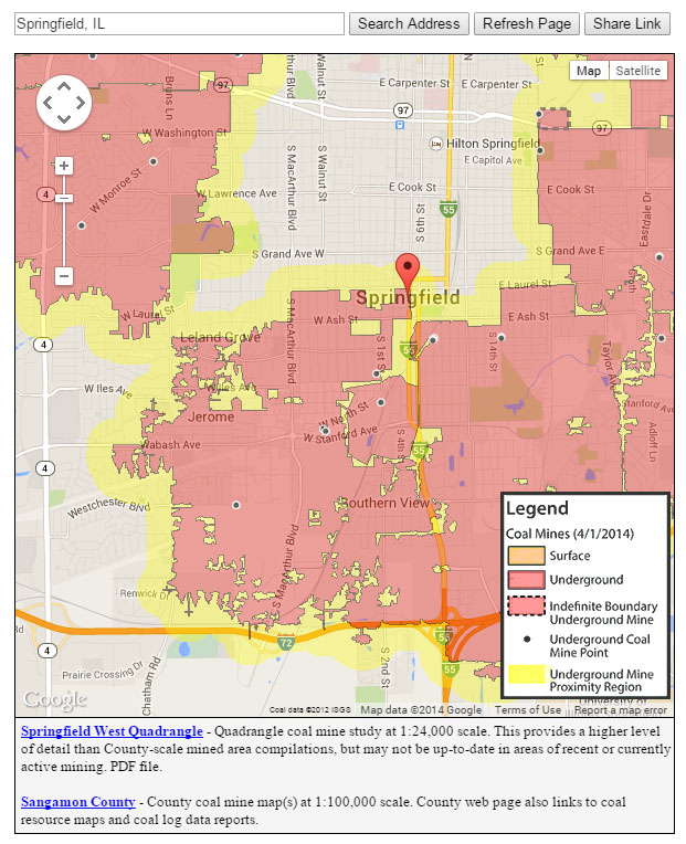
The Illinois State Geological Survey (ISGS) has estimated that 201,000 acres of urban and built-up lands may be in close proximity to underground mines. Their study also estimates as many as 330,000 homes may be undermined. Mine maps are often an excellent source for locating abandoned mines in a given area. The Illinois State Geological Survey maintains the state's largest collection of mine maps, and allows public access via the internet. In 2010, the ISGS created the Coal Mine Locator which allows the user to determine the proximity of a home or business to coal mines and underground industrial mines. This feature is available on the ISGS website at: http://www.isgs.illinois.edu/ilmines
Please note that the accuracy and completeness of the mine maps vary, depending on the availability and quality of source material. Little or no information is available for many older mines because mining activity was not regulated or documented until the late 1800's. Even then, reporting requirements were minimal. Also, early mine maps were often sketched by miners working in the mine at the time, or were constructed solely form memory. However, mine maps are a good source for determining if mines are present in the general area of your property.
Also, if you are purchasing a home or starting new construction, ask the seller or developer to disclose any information about underground mining or previous mine subsidence claims in the surrounding area. Ask neighbors and business owners if they are aware of a history of mine subsidence in the neighborhood. In some areas, the County Clerk's office or a zoning board may have information about past mine subsidence incidents.